
Tags
Bodlondeb woods, Conwy estuary, Conwy Marina, Conwy quay, little egret, local history, meadow pipit, memorial, Mulberry Harbour, Oystercatcher, redshank, river conwy, wigeon
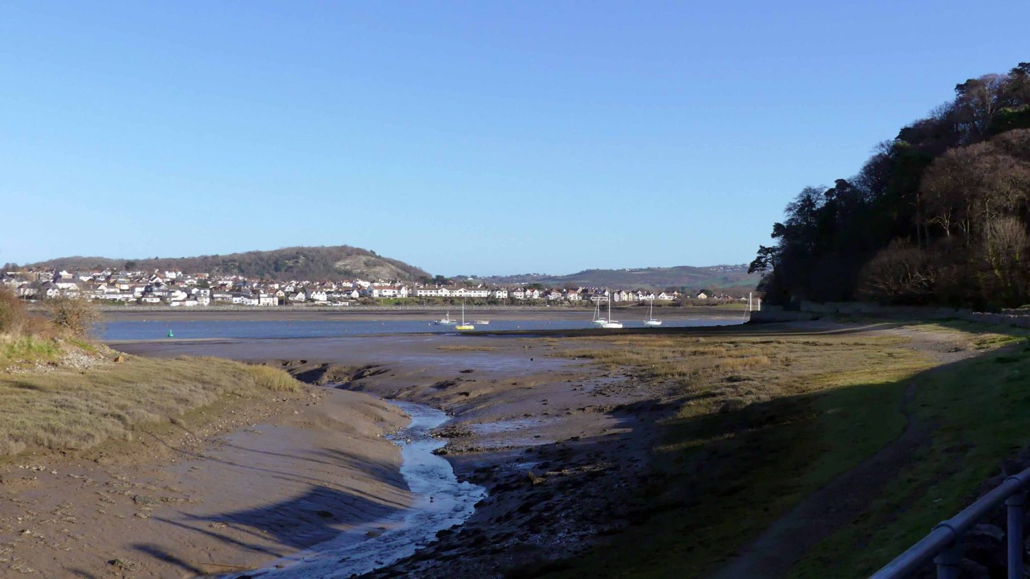
It was a view from Conwy’s town walls while on my earlier jackdaw trail that prompted this walk, reminding me that though I’ve often walked the Coast Path in both directions almost to and from the town and beyond, there were parts in the middle I had missed, including this stretch from the end of the quay around to the marina. It’s not a long walk and I imagine that at times it could get busy, but on this out-of-season winter weekday I met very few people and those I did all exchanged ‘hellos’ or at least a smile.
To my surprise the town was quiet when I arrived here today, with less traffic and people than I think I’ve ever seen; at not far off noon on a sunny winter’s day I’d thought it would be busier.
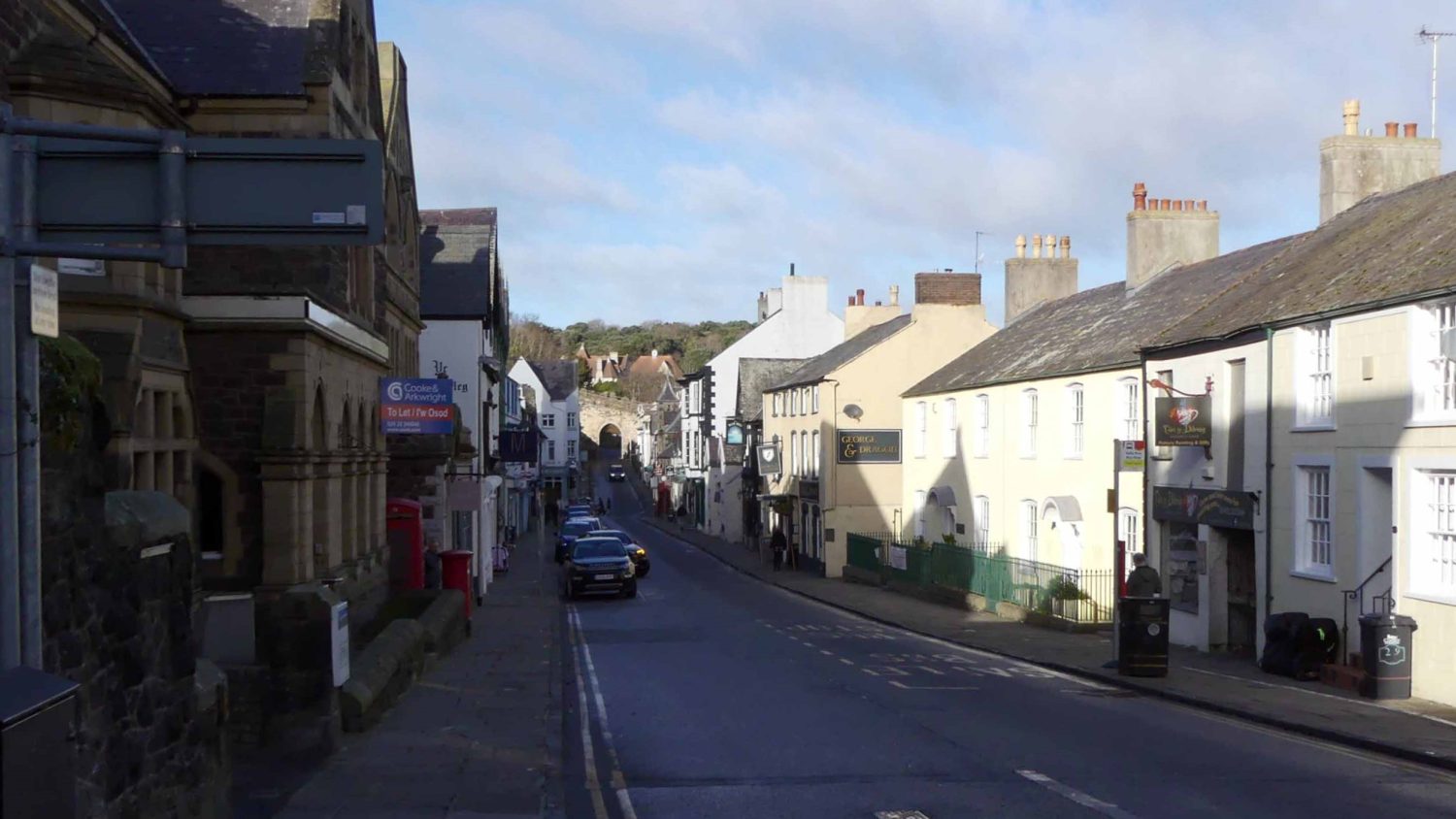
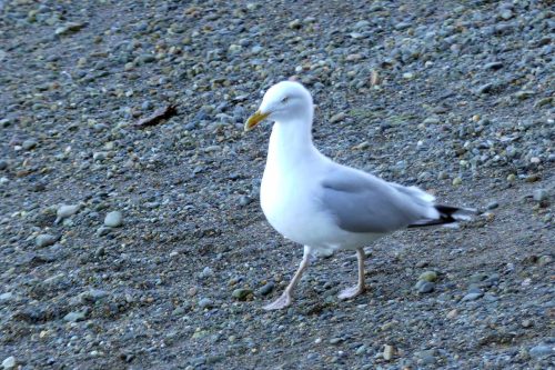
The quayside was almost deserted, emphasised by the scarcity of herring gulls calling or hanging about on the alert for an opportunistic snack.

The tide was out, which always changes the dynamic of a place too; many birds rest, conserving their energy for when the tide turns, hopefully bringing fresh food in with it. Numbers of herring gulls were gathered together sitting peacefully on distant sandbanks in the shallow water, while two nearby were alternately preening with just standing in the sunshine.
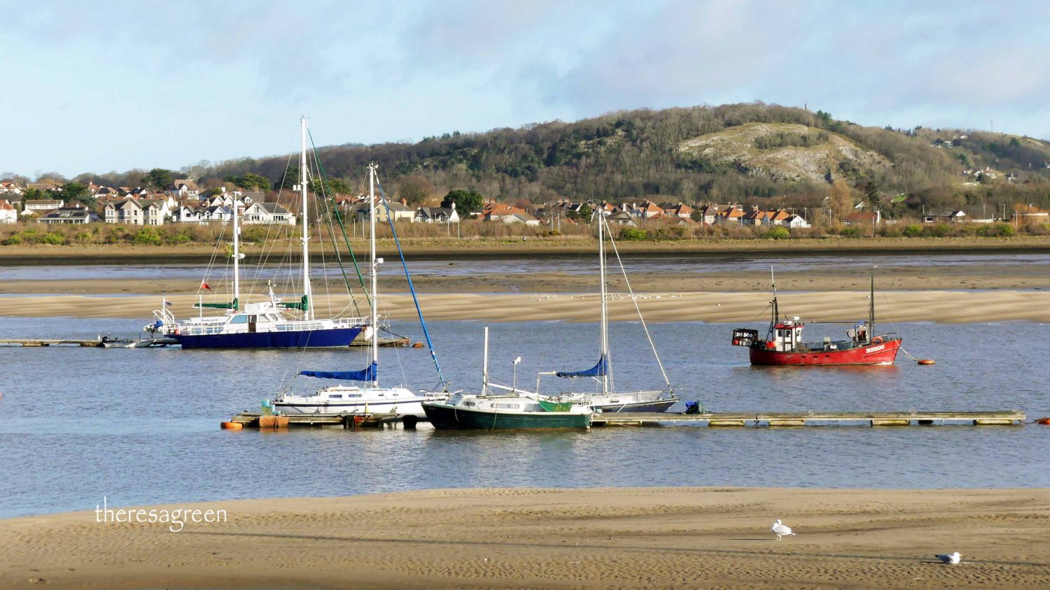

Other birds, like this oystercatcher and a redshank, continue to forage, stalking the exposed mud and sand on the hunt for buried shellfish.
The quayside is itself on the route of the Coast Path and accessible to walkers. Cyclists have either to dismount or take a detour around the town, but they do have the option to rejoin it at the point I was heading for a short way beyond the harbour wall.
Menai Strait & Conwy Bay special Area of Conservation

On the far side of the wall, a board informs that “The water you see in front of you is a Marine Protected Area. It is special because of the way the sea is channelled down the narrow strait, creating whirlpools and areas of fast currents, and then opens out into Traeth Lafan and Conwy Bay, where slow currents lead to sediments being deposited in large sand and mud flats. It is a wonderfully diverse area which supports a rich array of marine wildlife such as corals, sponges and brittlestars, and birdlife like common scoter, wigeon and oystercatcher.”
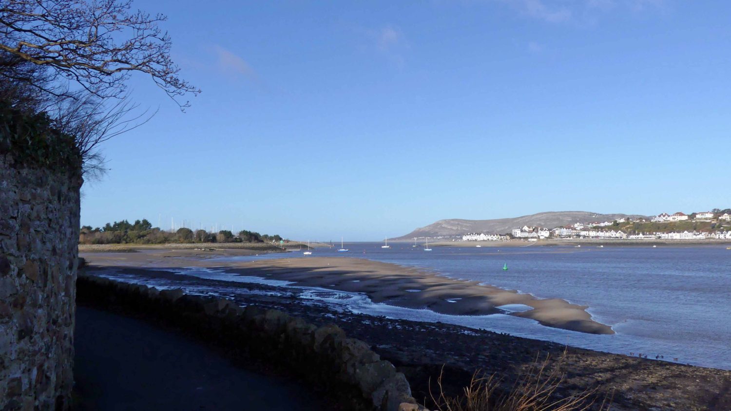
Beginning at the top of a gentle downhill slope, the first view from the path takes your eye across to the far side of the estuary to the distinctive hill known as the Vardre, rising behind the small town of Deganwy. The path looks intriguing. Curving around between the shoreline and woodland, I imagine each bend will reveal a different perspective on the panoramic views. I can’t decide whether the palm tree adds or detracts from the view, but it looked quite at home against the blue sky on this sunny day.
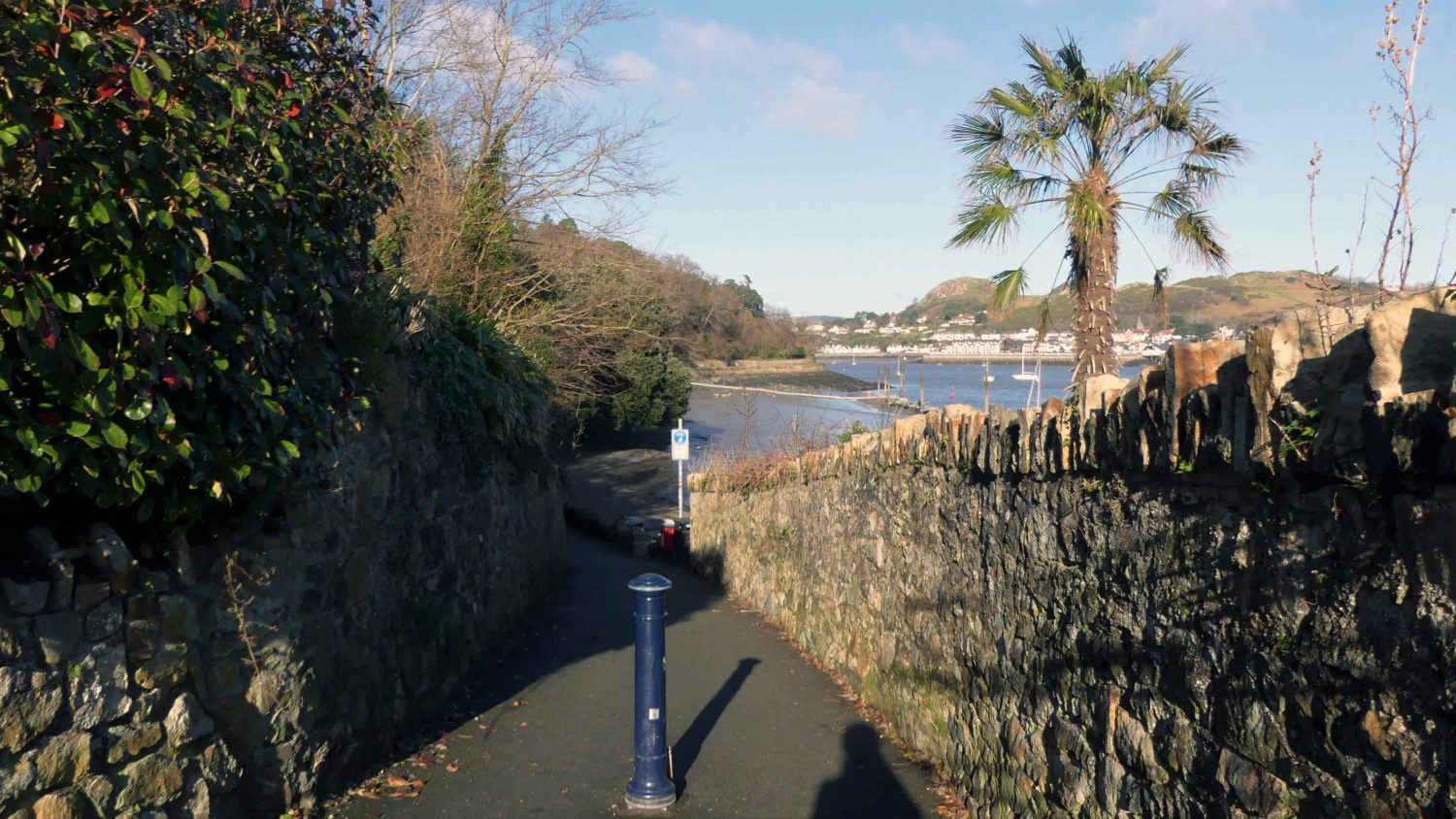
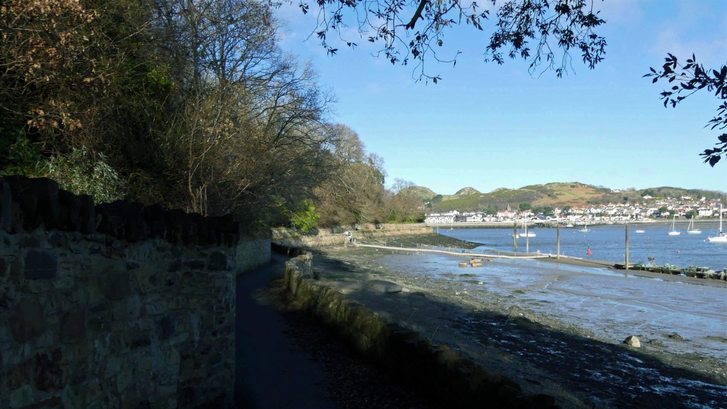
The path levels out and the wall lowers, opening up the view onto the exposed shore and the hills across the river.
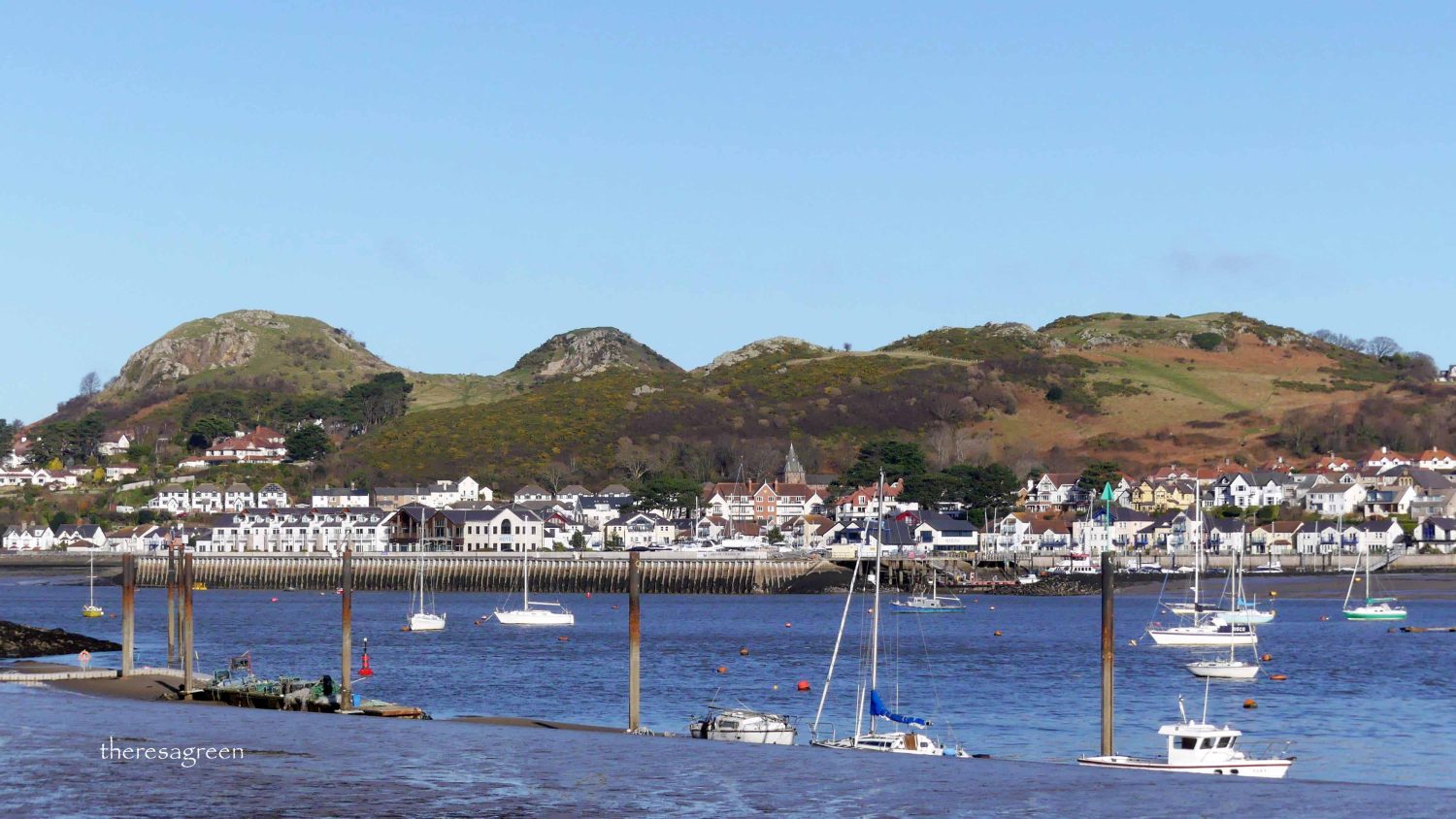
Rounding the bend you get a great view of Deganwy fronted by its promenade with the centrally-placed shelter and backed by the iconic double-summited Vardre.
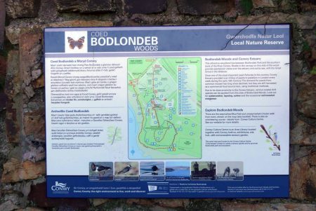
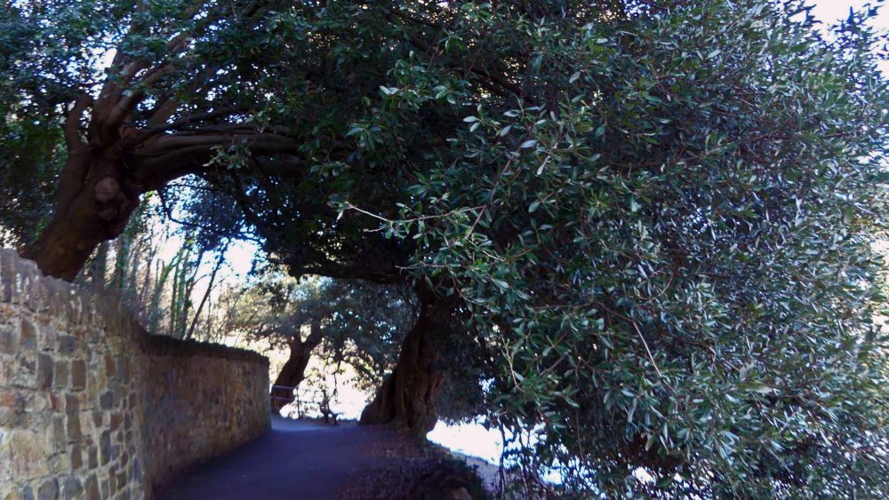
Bodlondeb Woods
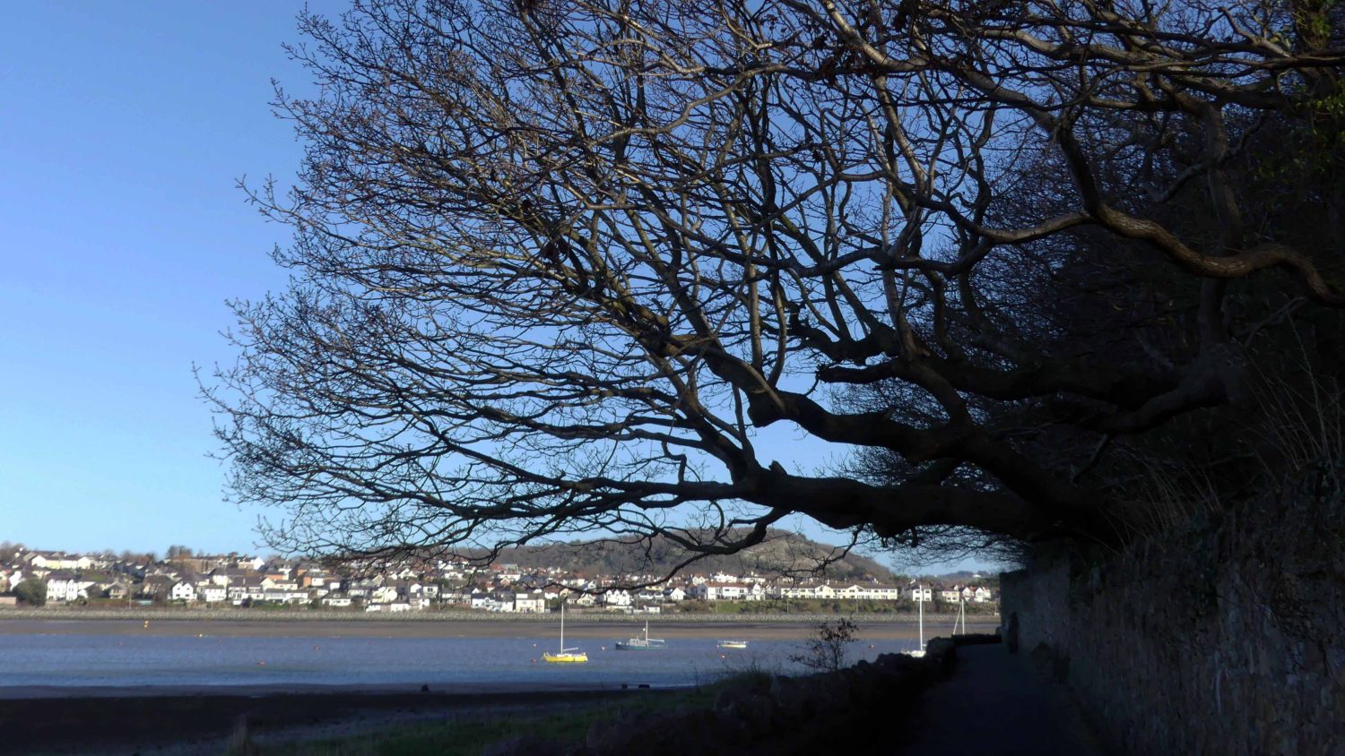
The woodland which shades the path and is contained behind the stone wall is Bodlondeb Woods. Located in what were once the grounds of a Victorian mansion, they are now managed as a Local Nature Reserve. Presently the woods are home to a variety of trees, including a number of non-native species such as this enormous holm, or holly oak which leans dramatically over the wall, extending almost all of its branches and heavy evergreen canopy of leaves across the path. It seems plans for future management of the woods include the removal of some of the introduced trees to encourage native species and improve conditions for wildflowers. I’d like to think this one will be safe for as long as it stays healthy.
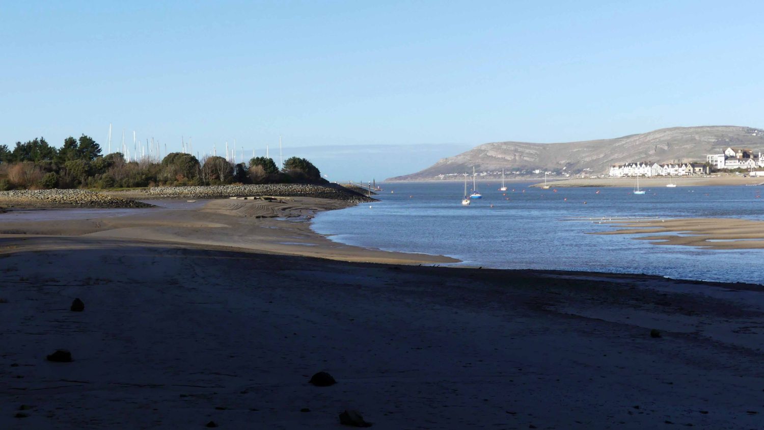
Rounding another curve the view opens up to the headland of the Great Orme and the point at which the river meets the Irish Sea and the end of the Menai Strait.
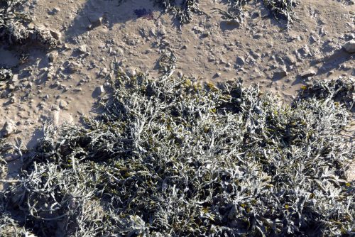
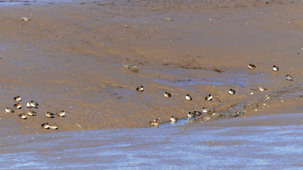
As I stopped to photograph this view, a little party of wigeon swam into view , they were travelling slowly along the water’s edge, their eyes on the water, foraging for food. There’s a lot of seaweed along this part which in places covers piled rocks that slope from the path boundary down into the water. Exposed now by the receding tide, partly coated with mud and drying out in the sun, it wasn’t smelling particularly pleasant.
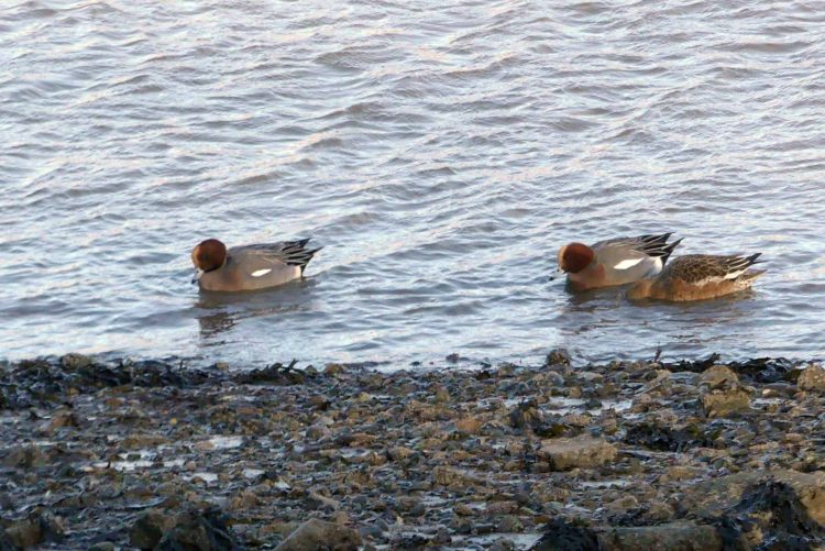
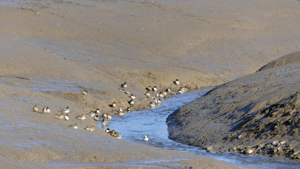
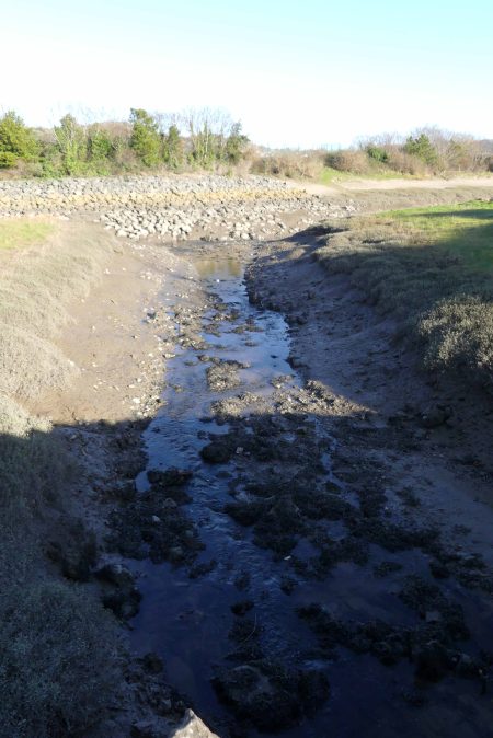
A little further along, some distance away I could make out a group of birds on the edge of a stream of water coursing along between high banks of mud. They were difficult to see in the bright sunlight, but having seen the three wigeon a short while before, and from their ‘gis’, I’m sure these were more of the same.
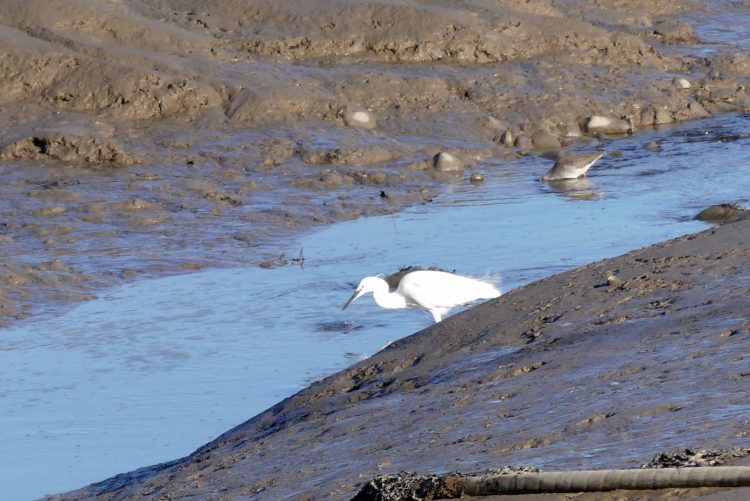
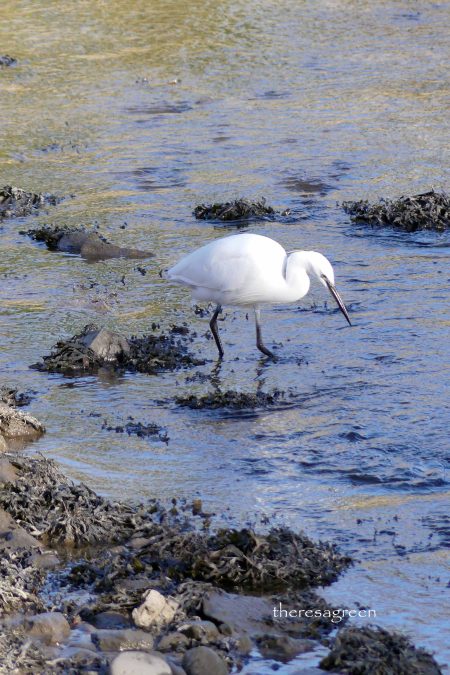
Half-hidden beneath the rise of a mudbank a little egret was focussing on something in the shallow water, intently following its movements, turning its head and shifting position, ready to strike. No luck this time though. The redshank behind the egret demonstrated a different hunting technique – it had its head almost completely immersed in the water.
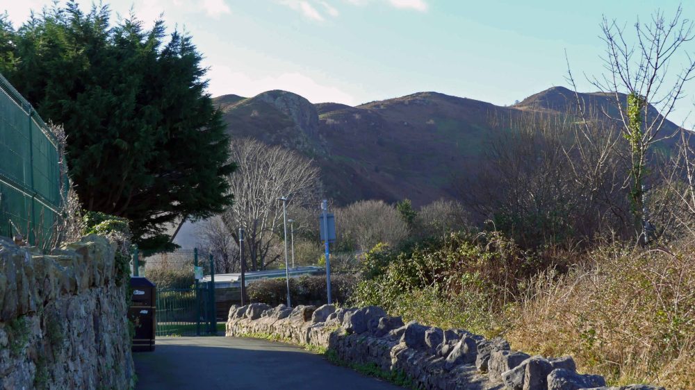
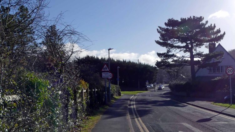
Rounding another bend, the path passes by a school and ends quite abruptly, emerging out onto a path running alongside the A547. The view in front of you now is filled by the rugged bulk of the headland of Penmaenbach, a part of the Carneddau Mountain range which marks the northern end of the Snowdonia National Park.
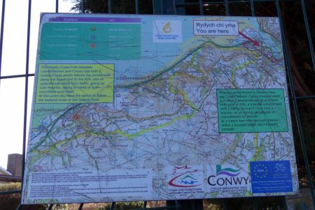
If you were trekking the length of the Coast Path, you’d now have a decision to make. You can continue to follow the Coast Path towards Llanfairfechan, which after a bit of detour through a housing development you can rejoin, or you can take the considerably longer, but spectacularly scenic route up and over Conwy Mountain and across the hills. A map here shows your options, although it’s a bit high up on the fence and the ‘you are here’ right at the top of it, which is not too helpful to less-tall people like me.
As I’m not trekking the whole length of the Coast Path, I had already planned to make the Marina today’s destination as it’s still more or less on the Path and is the site of some interesting local history and humanly-altered geography. To reach it I turned right here to follow the road, which soon crosses over the A55 Expressway, then cut through the housing development to reach the walkway that runs the length of the frontage of the Marina.

Conwy Marina
Despite how it now blends into the river scenery, the Marina is not a natural harbour, but came about as a result of the construction of the Conwy Tunnel, which takes the A55 Expressway beneath the estuary and was officially opened by Queen Elizabeth II on the 25th October 1991. The site the marina now occupies was once a part of Morfa Conwy, but one of the first processes undertaken when the tunnel work began was to excavate a huge basin, within which six sections of the tunnel tube were cast. When they were completed, an opening to the estuary was created, filling the basin with water. The tunnel sections were kept afloat with buoyancy devices, towed to their final positions in the estuary and lowered into a trench dug across the bed. The water-filled casting basin was developed to provide 500 pontoon berths, making it the largest marina in Wales, and opened in 1992.

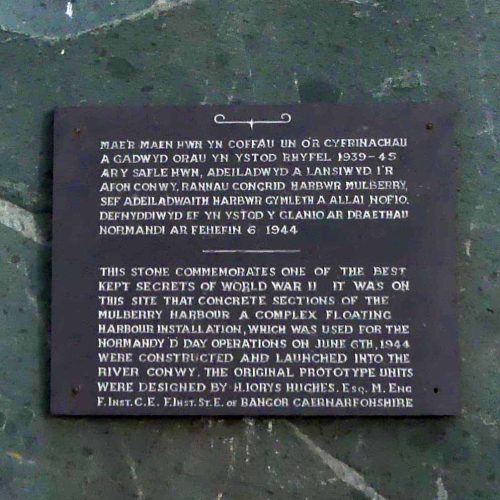
Mulberry Harbour
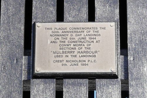
The plaque on the seating shelter overlooking the harbour commemorates both the 50th anniversary of the Normandy D-day landings of WWII, and also the construction here at Conwy Morfa of the Mulberry Harbour which was used in the landings.
‘Mulberry’ was the codename for a World War II project to build parts for two harbours which would be floated to northern France to aid the re-occupation in 1944. The original prototypes for them were designed by Hugh Iorys Hughes, a civil engineer originally from Bangor who foresaw that the Allied troops would need to build harbours on distant beaches because the main French ports were too heavily guarded. From 1942 to 1944, almost 1,000 men worked here to construct three giant caissons, known as Hippos. A major training exercise in July 1943 demonstrated the difficulties of landing troops and supplies on beaches, and in its wake thousands more men around Britain were diverted to the project, constructing more than 200 caissons in various parts of the country. The structures were towed to France and linked to form two harbour walls, enabling large numbers of vehicles, personnel, communications equipment and other supplies vital to sustaining the frontline forces as they pushed deeper into enemy territory, to be taken ashore.
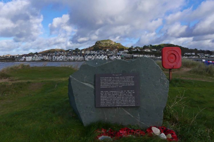
A further memorial can be found beyond the marina on Conwy Morfa, reached either from here by following the path around the left of the marina, or if the memorial is your destination, from the nearby car park.
Marina to Conwy Quay

Leaving the memorial I retraced my steps, followed the walkway that runs the length of the marina, turned right past the The Mulberry restaurant and bar and cut across its carpark to get back to the A547 and the path back to the quay.
The little egret had worked its way further upstream along the muddy channel and was much closer to the path now, almost at the point where the stream runs beneath the road. They are such a joy to watch, stirring up the surface of the sand or mud they are standing on then watching intently for a movement, keeping focussed, waiting for the right time to strike with its long dagger of a bill.
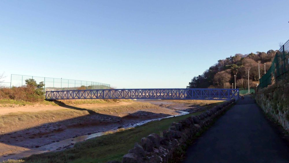
A blue-painted footbridge crosses the stream; it’s closed off at the moment, otherwise I’d have been tempted to walk over it to see where it goes.
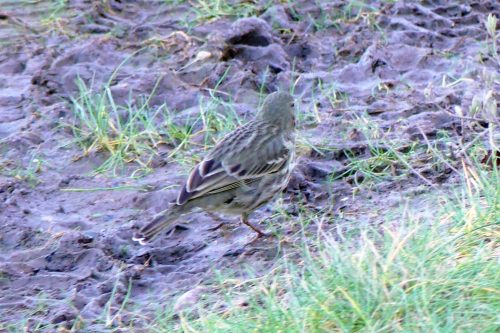
On the muddy but grassy bank below the wall I spotted a bird moving around, surprisingly well camouflaged it took a minute of trying to focus in to realise it was lovely plump meadow pipit.

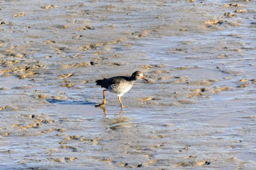
The mud is so soft and oozy that even this lightweight redshank (they weigh only about 120g) was leaving quite deep footprints behind it.

The resting flock of ducks was still there in the sheltered valley between the sloping mud banks. With a better view of them from this angle I was happy they were indeed wigeon, with one or two redshanks in amongst them too.
Another huge tree leaning over the wall may be a sessile oak (or may not); I’ll have to come back and check in a few weeks time when it has leaves.
The woodland is on a hill and as the sun lowers behind them, the trees cast a wide shadow over the shore.
Another tall tree with a interestingly contorted branches frames a view of the castle and bridges half-concealed in a shadowy haze.

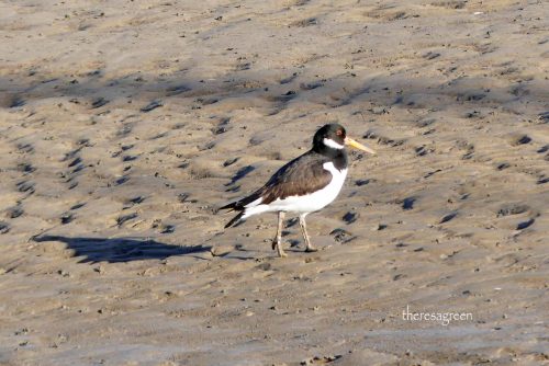
There were foraging birds on the shore now, jackdaws were probing the pebbles, and a redshank and an oystercatcher were inspecting the muddy sand. A herring gull was watching the oystercatcher intently, whilst stalking towards it.

The oystercatcher stopped, probed its bill deeply into the mud and pulled out a large shellfish, a mussel I think.

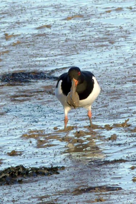
I must have looked away for a split second and missed the action, but next thing, the herring gull has the prize! It either snatched the mussel directly from the bill of the oystercatcher, or the oystercatcher dropped it momentarily and the gull grabbed it. The poor oystercatcher left the scene, probably in a huff, while the herring gull carried its ill-gotten gains away; now it just had to work out how to open it.


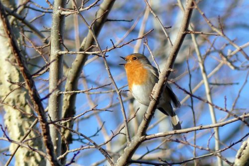
At the end of the path the robin was singing as it had been when I began my walk, but this time I could see him perfectly and allowed me to take his photograph. I thanked him of course.

I really enjoyed reading this, thank you! We’ve walked that same path and we’ve been to Conwy Marina many times but I don’t think I’ve ever stopped to read the memorial or realised that Mulberry harbour sections were built there. It does explain the name of the pub which always struck me as a little odd! 🙂
LikeLiked by 1 person
Hi, sorry for the delay in replying – I’m happy you enjoyed my account of this walk and that the mystery of the name of the pub has now been solved!
LikeLike
I do this walk regularly. Your article was excellent. Thank you for publishing it.
LikeLiked by 1 person
Thank you for your kind comments Mel, I’m not surprised you walk this way regularly, it’s a lovely and interesting walk and I hope I managed to do it justice. I’ve done it a couple of times since too, carrying on around the Morfa and will definitely be doing it more often myself now. Enjoy your walks and let me know if you spot anything interesting along there, best wishes.
LikeLike
Thank you, a great description of your walk.
LikeLiked by 1 person
Thank you, I’m happy you enjoyed it.
LikeLike