• Home
  • about
  • about the photographs
  • Rhos-on-Sea
    • St.Trillo’s Chapel
  • Bryn Euryn Local Nature Reserve
  • Bryn Pydew Nature Reserve
  • Mynydd Marian
  • Coed Pwllycrochan Wood
  • Rhiwledyn Nature Reserve
    • Grey Seals in North Wales
  • Great Orme
  • Llanddwyn Island & Newborough Warren
  • The Wales Coast Path
  • Wildflowers of Coastal Paths, Cliffs and Dunes

everyday nature trails

everyday nature trails

Category Archives: Rivers of Wales

Following a river to a Fairy Glen

15 Thursday Mar 2018

Posted by theresagreen in Fairy Glen, Local Nature Reserves, Nature of Wales, North Wales Path, Old Colwyn, Rivers of Wales

≈ 18 Comments

Tags

Afon Colwyn, grey wagtail, river Colwyn, robin singing

The myriad of little rivers and streams that run from our mountains and hills come alive following prolonged rainfall or when filled with melted snow. Many of them are inaccessible and flow through privately owned land, so we are privileged here to be able to enjoy close access to the sights and sounds of one such waterway: the river that flows through the village of Old Colwyn and ends at Colwyn Bay, both of which take its name – the river or in Welsh afon, Colwyn.

This walk follows a length of the river Colwyn upstream from where it reaches the sea  at Colwyn Bay at the end of the Promenade, takes the scenic route through the oldest part of the village of Old Colwyn then continues to the far end of the wooded dingle of Fairy Glen and back again. It’s not a long walk and mostly fairly easy going. It follows a section of the North Wales Path and is also part of the Old Colwyn Heritage Trail so combines a bit of local history with nature and wildlife, which ticks all of the boxes for the perfect winter walk for me. 

Splash Point of the river Colwyn into Colwyn Bay. Snow-capped Clwyddian Mountains on the far horizon.

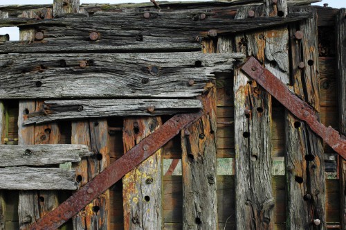
The last few metres of the river’s length are contained and manipulated by stone and concrete to direct its waters under roads, bridges and the viaduct, then finally a culvert beneath the Promenade channels it to its end at a Splash Point from where it cascades into the sea.

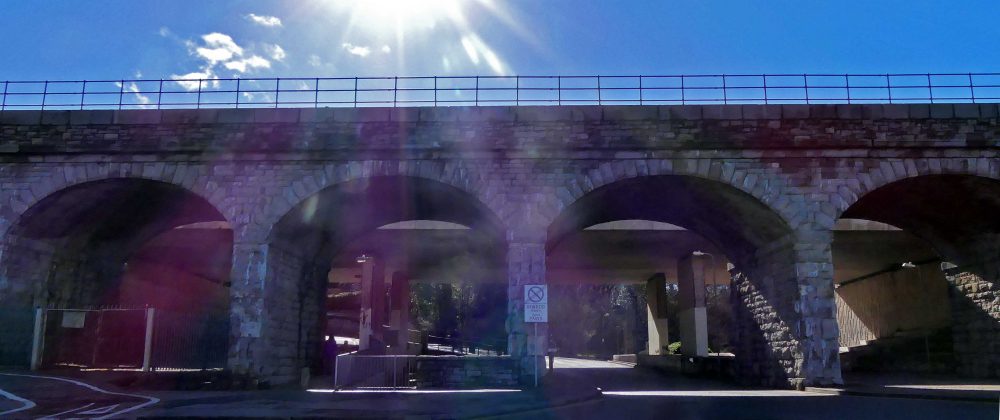
The viaduct was built in 1847 as part of the Chester-Holyhead railway line engineered by Robert Louis Stephenson. The bridge behind it carries the A55 North Wales Expressway

Beneath the viaduct, know locally as ‘The Arches’, the surface of the water is textured as it rushes over its stony bed and its sound amplified by the stone walls that contain it, still audible above the noise of traffic and the occasional train passing overhead.

Once beneath the bridges and on the path past Myn y Coed woodland calm is restored and the sounds of the river and birds singing fill the air.

180308-OCWYN-River Colwyn 20-Daffodils
180308-OCWYN-River Colwyn 19-Cliff Prout memorial

I stopped on the footbridge to listen and to check for Grey Wagtails that sometimes hunt along this stretch of the river; none here today but I know they have other favoured spots.

upstream from the footbridge at Myn y Coed

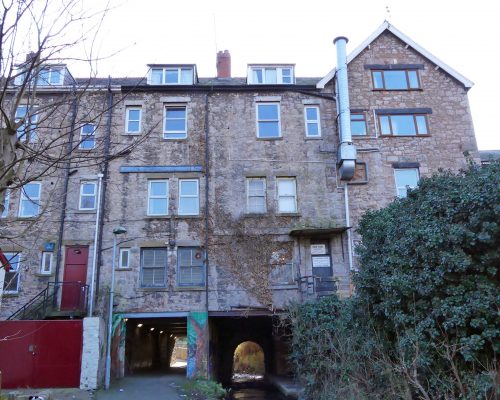
The path upstream curves around the corner to run parallel to Beach Road, passing in front of the building that was once the Coachhouse to the Myn y Don Mansion. The river races down the slope here, carrying with it bits of shrubbery from somewhere along its path.

Lovely to see a few Spring wildflowers here.

180223-OCWN-1434-Tan y Bryn Gds-Daisies
180223-OCWN-1441-Myn y Don-Celandine
180223-OCWN-1441-Myn y Don-Primroses

Near the beginning of Tan y Bryn Gardens is a weir with blocks of stone either side that look as though they may once perhaps have had sluice gates?

There’s an interesting variety of native and more exotic trees here with an under-storey of shrubs and plants that is perfect for birds. Today Blackbirds seemed to be everywhere, singing from variously elevated spots or rummaging around in leaf litter. There were at least three males in close proximity to one another, resulting in much chasing. The one in my photograph had been singing until I arrived and put him off his stroke.

Carrying on through the gardens there were robins singing from several spots too and I finally caught one in action.

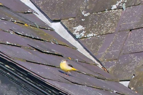
Almost at the end of the Garden path I was thinking I still hadn’t seen a Grey wagtail and that sometimes I’ve had better luck seeing them hunting on the nearby rooftops… then a bird skimmed past just over my head making that familiar rattling call. A wagtail that, lo and behold, carried on over the water to the very rooftops I was standing looking at. Although some distance away, it was a lovely colourful one with bright yellow breast and rump, that stood out nicely against the blue-grey slates and patches of lichen.

I had reached the tunnels beneath the buildings that allow people and the river to pass through them.

The tunnel is short, lit artificially and its walls are decorated with colourful professional-looking graffiti. It’s not my favourite part of the walk though, especially when as today it was littered with rubbish and doggy deposits. Such a shame as the path to here was spotless.

I usually walk through here at speed, admiring the wall art out of the side of my eye as I pass it, but today I stopped to photograph my favourite part of it. It depicts the buildings above where they front onto Abergele Road, harking back to the days when the tram was running. Next to that image is one of the viaduct before it was obscured by the Expressway bridge.

At the other end of the tunnel a sign indicates the way back to the beach and the North Wales Path logos are beneath it.

The path stays by the river through this attractive little area, named Llawr Pentre which is the oldest part of the village, then leaves it for a short while as you take the steps you find on your left. At the top follow the signs that point right to Fairy Glen and the North Wales Path.

FAIRY GLEN

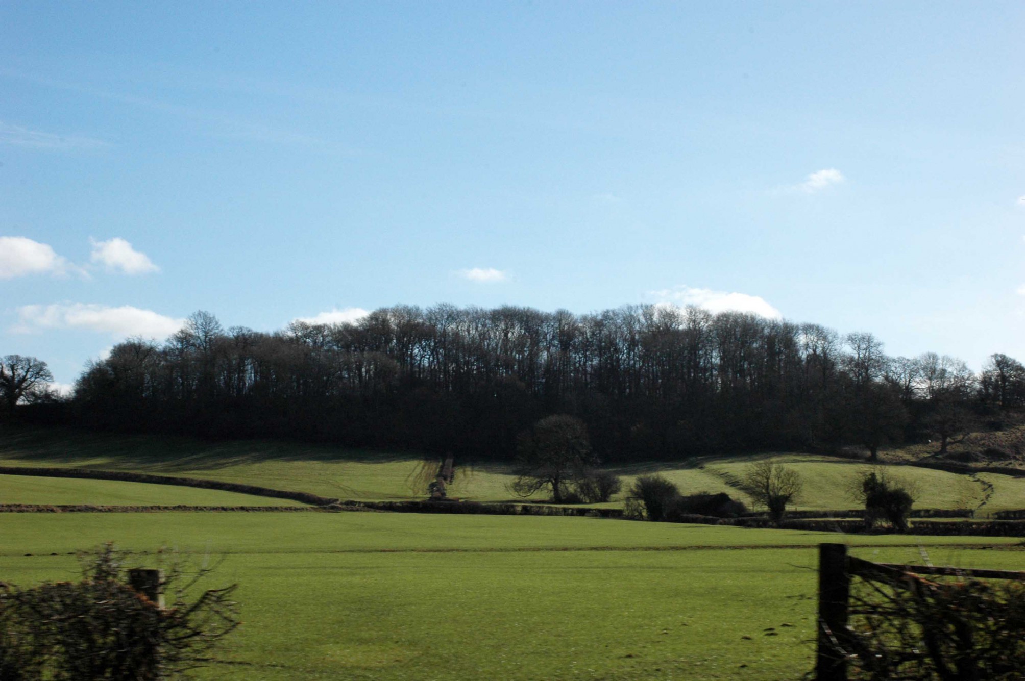
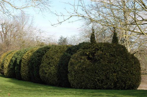
The Local Nature Reserve of Fairy Glen in Old Colwyn is one of several places locally known as ‘dingles’. Dingle is a charming and evocative noun used to describe a small, narrow or enclosed, usually wooded valley or a deep hollow or dell. Fairy Glen was once more manicured and a much favoured place for holidaying Victorians to take in the fresh air on a leisurely riverside stroll. Today the pathway is on the route of the North Wales Path, but is mostly used locally as a shortcut to the village centre or by folks walking their dogs. It may not appear as groomed as it once did, but this fragment of a once-extensive ancient woodland is cared for and appreciated and it provides a habitat for a good variety of wildlife, particularly woodland birds. There are some lovely big old trees and shrubs here, but the greatest draw and asset for wildlife is surely the fresh clean accessible water. 

At the base of a tree I found golden-yellow Lesser celandines, some of them already ‘going over’.

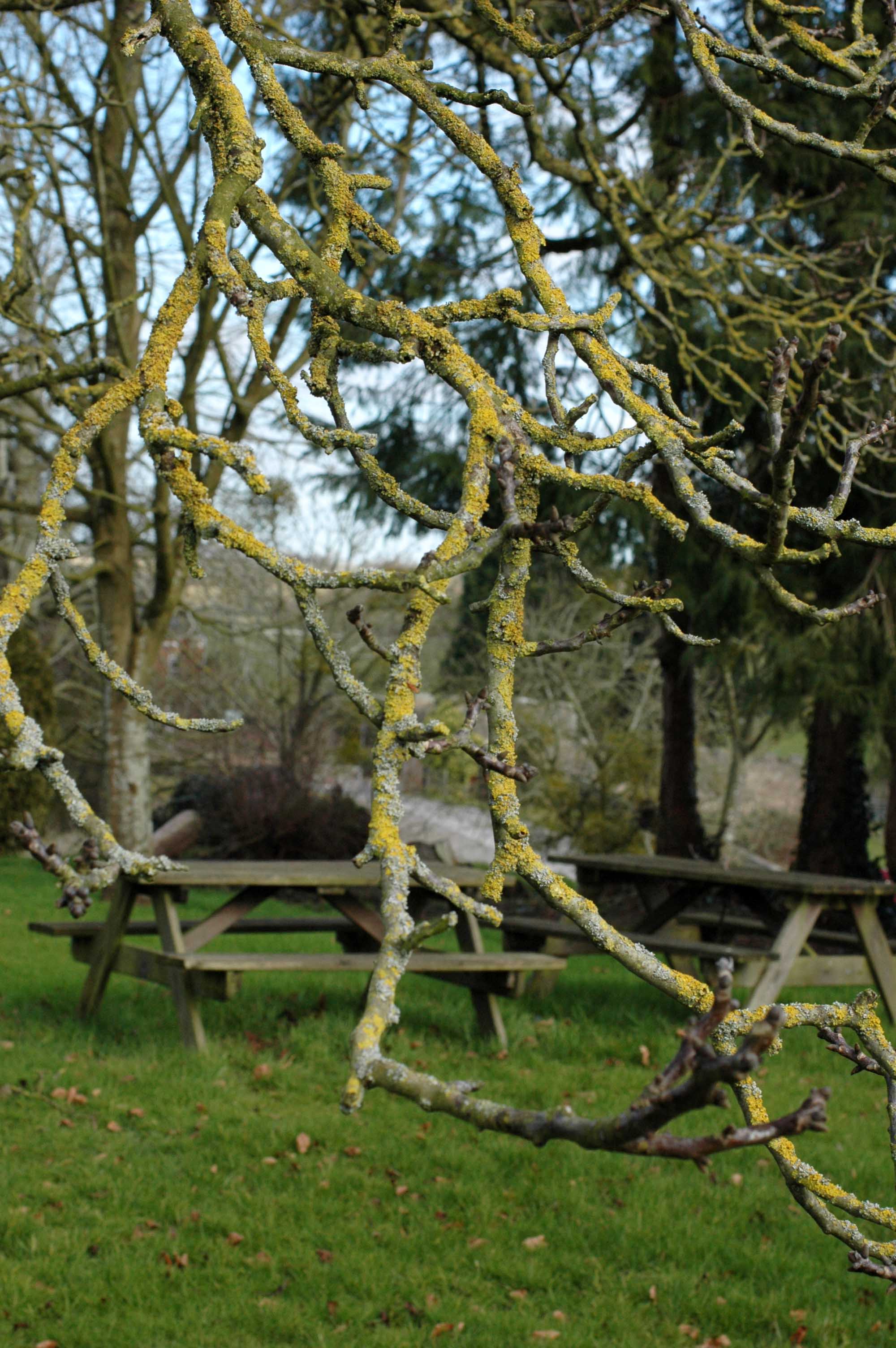
Most of the length of the path is fenced allowing flora and fauna to remain undisturbed. The fence rails are a great place to spot birds too; many use it as a perch and some as a place to forage for insects amongst the ivy.

There were a number of Blue tits foraging in the trees around and overhead me and I heard Great tits singing. The songs of Robins rang out at regular intervals, each one pausing occasionally to listen to others nearby then responding. I always thought that this might have been why the ’round Robin’ style of singing we learnt at school was so-named, but apparently not – it relates to much more boring things like circularised documents. I prefer my own version! There were Blackbirds all over the place here too. This one took to the fence while I passed but soon resumed his hunt for worms in the leaf litter below.

Wild garlic is growing fast and the warm sunshine was already drawing out its distinctive aroma.

The damp shady conditions here are perfect for ferns.

I had a lovely close encounter with a small flock of charming Long-tailed tits.

180223-OCWN-1353-Fairy Glen-Long-tailed tit 1
180223-OCWN-1353-Fairy Glen-Long-tailed tit

Rainwater channels into the river at this weir adding to its volume creating a considerable foamy ‘race’ down its length.

This stand of tall old pine trees is a good spot to look out for Coal tits; I’ve seen them here on several occasions, but not today.

At the base of tree a collection of new Spring greenery of varying shades and leaf forms; ferny Cow parsley, elegant Arum and the round leaves of some pervading Winter heliotrope which seems to be popping up all over the place lately. There are also a few leaves of Nettle and the ubiquitous Ivy.

The path through the Glen ends at Pen y Bryn Road. As at the beginning of the path at Myn y Don there is a plaque commemorating a local man named Cliff Prout who did a tremendous amount of work improving the public local green spaces on behalf of this community. The world needs more Cliff Prouts – he did a great job.

THE WAY BACK

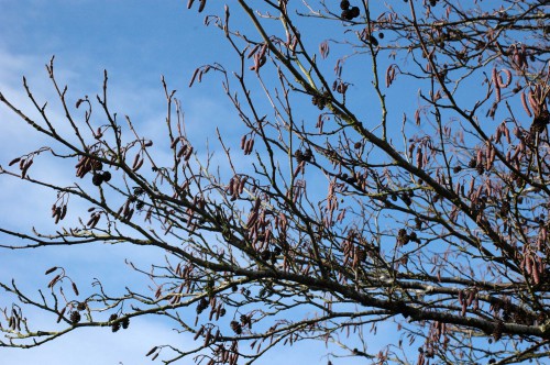
There’s much to be said for a circular walk, but I find it can be just as interesting to go back the way I came. I often see things I missed on the way through being distracted by something I spot; the perspective is different, the light is different and of course the time is different. I tend to ‘save’ things that aren’t likely to move for a closer look on the way back too, such as these trees. I liked the contrast of shapes and shades of the evergreens seen through the more delicate catkin laden Hazel in the foreground and all set off beautifully by that beautiful deep blue winter sky.

I met the Blackbird again, still hunting worms successfully, he’d just swallowed one as I took his picture.

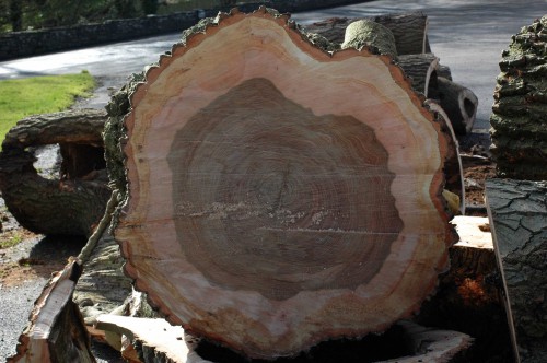
I had a closer look at this felled tree which I think from the bark may be a Sweet chestnut. It’s wood has been left to integrate into the fabric of the woodland floor to provide habitat for invertebrates etc. I hope it gets left alone and is not purloined by someone with a wood-burner to feed.

This was a huge tree, a section of its trunk would easily make a small dining table.

A flowering Dandelion and more shoots of Wild garlic.

This enormous Oak tree near the entrance/exit to the Glen fascinates me. It has stabilised itself in an almost-perpendicular position with a complex network of roots that are as thick and sturdy as branches, right on the edge of a steep bank. Beneath it are hollows you can see straight through. Perhaps this is where the fairies live.  

A last look at another stand of elegant, pale-barked trees whose top branches turned silver in the sunlight.

And then the river on its way out of the Glen.

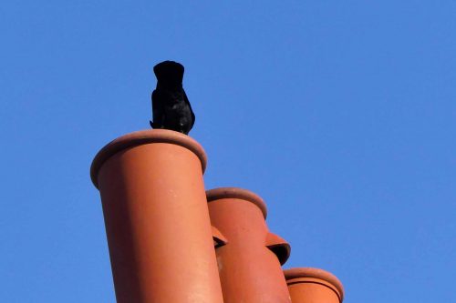
Leaving the Glen and walking back past the cottages I stopped to watch Jackdaws  gathered on the chimney pots. I’m not sure what they were doing, possibly checking for any insects or spiders that may have been hiding in them, or maybe prospecting for nest sites; whatever they were doing they were disappearing right into them.


Back in the Gardens I stopped to admire  the flowers; clumps of snowdrops, daffodils and a stunning display of richly coloured hellebores all enjoying the sunshine. No insects yet  though.


I couldn’t resist taking this shot of a perfectly matched couple walking hand in hand ahead of me. I hope they don’t mind.

The view towards the end of the gardens with the Coachman’s cottage in the bottom left corner.

All overlooked by the tower of the Folly up on the hill.

I am ever in awe at the size of some of the pine trees that grow here

so I was sad to see that the foliage of one of them looks has turned brown as though it may be dead.

A Robin checked out a dramatic dried seed head

while a Wood pigeon investigated a mossy rooftop.

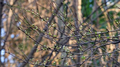
Then to finish, a promise of imminent Spring: a Wild Cherry tree with new green leaves and blossom buds about to burst.


Share this:

  • Facebook
  • Pinterest
  • Twitter

Like this:

Like Loading...

Curlews are Back in the Field

05 Saturday Aug 2017

Posted by theresagreen in bird behaviour, Birdwatching on North Wales coast, Nature of Wales, North Wales, Rhos-on-Sea, Rivers of Wales, wading birds

≈ 10 Comments

Tags

Afon Ganol, Curlew, curlew flock

July 17th 

Curlews are back. That is to say I’ve just noticed some in the field as I drove past, I don’t know when they got there exactly. There were just a few for now, a lot of Curlew that return here will have been breeding, or bred in Iceland, but their return here following a few months away each year is one of the signs that summer is rapidly coming to an end.

More used to seeing these wading birds solitarily stalking amongst the rocks of Rhos Point, I was amazed the first time I saw them gathered together in a significant number in this field, although it did go some way to enlighten me as to where birds go when the tide’s in. That initial sighting was was back in 2011 when I came here to live and each year since I’ve looked out for them, hoping they’ve had a successful breeding season and that their numbers will be good. (Not that I know what would be classed as a good number; nowadays the curlew is a threatened species, and I have no idea how present day numbers compare with historical ones for this site.) I’m not confident counting birds, but last year by my reckoning there were somewhere around 80-100 of them here at any one time.

17th July 2017-Curlews and cows

I’ve wondered about the attraction of this particular site as a gathering place. In the present day, as fields go this is not a particularly large one and it probably qualifies as ‘rough pastureland’ having coarse grass, a generous sprinkling of thistles and not too much else. It is farmland, so the birds often have to share the space with large grazing animals; presently it’s cows, earlier in the year it was sheep. It is bounded on one side by the Llandudno Road, by houses on another two with another field fenced off behind it.

February 2017-Sharing with sheep

On the plus side, it’s conveniently close to the shore & a short flight gets them them there in minutes.The ground here is probably rich in invertebrates as the animals keep the ground well manured, and much of it it floods easily and holds the moisture, keeping it soft for probing with their long bills. 

The birds must feel safe here too, when not foraging the flock takes time out  to rest and preen their feathers.

Curlew resting, preening & bathing

They seem to be here during times of high tide when there is no accessible shoreline for foraging. They seem to instinctively know the exact moment the tide is optimally in or out and some trigger suddenly alerts them to take off as one and head back there.

Heading back to the shore

Maybe that’s all there is to their choosing this spot, but it could also be connected to the past history of the land within which the field is located. Going back to the beginning, a clue lies in the meaning of the name of the village, Rhos-on-Sea, or more properly Llandrillo-yn-Rhos: the Welsh word rhos, translating as ‘marsh’. In the distant past, before the construction of sturdy sea defences, high tides would have reached further inland than now and flooded much of the low-lying ground here between it and the hills, forming an extensive salt marsh. The flat area between the Little Orme and Bryn Euryn, from where I took the photograph below is the northern end of the valley of the Afon (river) Ganol, once a significant river which flowed into Penrhyn Bay and also into the tidal river Conwy at its southern end. Along its length several small streams also fed into the river. 

July 2017-Looking down onto the ‘curlew field’ from Bryn Euryn

Looking down onto the well-ordered village of Penrhyn Bay with its network of roads and the modern-day golf course, it’s hard to visualise the wild place this once was, although following sustained heavy rainfall it is easier to see how wet it must have been.

January 2014 -Looking down on the flooded field where curlew, oystercatchers, redshank may be seen feeding amongst sheep

The Afon Ganol was by all accounts a dangerous tidal strait, and it formed a natural barrier rendering the land beyond the valley, then known at the Creuddyn Peninsular far more more isolated. Crossings were difficult; the river could be forded here, although the area was extremely marshy. Then in the 1800s, embankments were built at either end of the valley to allow land reclamation.

The effort and work undertaken to drain the marsh must have been massive, and hugely expensive, but by 1912 the OS map shows the Afon Ganol as being culverted under the Llandudno Road to the golf links, with a culvert going out to sea, but with still a large marshy area remaining. The establishment of the golf links then required further improvements to drainage and a new outlet for the diverted river was constructed. Dug 2′ below the bed of the river and the link’s ornamental lakes, this outlet then enabled the river and the lakes to be emptied during intervals between tides, keeping the golf course dry.

Today the Afon Ganol remains as a culvert with tidal outfall structure, which was updated in 2011 to decrease the risk of flooding.

A section of a remaining water course bends around the back of the rugby field

Interestingly, although the original river is now just a meandering waterway and ditch, in part diverted and culverted, it remains still the county boundary between Conwy and Denbigh.

Welcome back Curlews, the place is not the same without you.


Share this:

  • Facebook
  • Pinterest
  • Twitter

Like this:

Like Loading...

A Graveyard for Ships

24 Tuesday Mar 2015

Posted by theresagreen in The River Severn, The Severn Way

≈ 2 Comments

Tags

Purton Barge Graveyard, Purton Ships Graveyard, ships graveyard on bank of River Severn

Gloucestershire

Gloucestershire, showing the River Severn – the wide strip of blue bottom left of map

The lower reaches of the River Severn are a few short miles away from the city of Bristol, but out there by the river and its Estuary, under wide open skies and exposed to the wind blowing in from the Atlantic you could be in a completely different world. It is a landscape of contrasts: historical and modern. Spanned by the two beautiful Severn Bridges linking England and Wales, it is also the location of four Nuclear Power Stations, but still along its banks are secret salt marshes, historic inns and isolated farms.

A walk here is good at any time of the year, but it is perhaps at its most atmospheric and exhilarating in winter, when low sunlight gives the water a silvery sheen and at low tide flocks of wild birds feed in the rich ground of the estuary.

The River Severn at Purton at low tide

The River Severn at Purton at low tide

At high tide the river is full to the brim, and is often choppy with waves breaking on the shore. We arrived at low tide when vast stretches of sand and mud are revealed.

150218TGBR79-Reeds

We continued our walk along muddy paths through the reedbed and it wasn’t long before we began to see evidence of the presence of vessels and had to take care not to trip over projecting pieces of wood and metal.

150218TGBR145-Sheerness

The old narrative board explains that the banks of the River Severn have historically suffered from erosion by the tide. Redundant and otherwise unwanted vessels were beached on the foreshore and allowed to fill with silt where they formed a barrier and helped prevent the river eroding in to the nearby canal embankment. The various working boats now form one of the  largest collections of historic inland waterway craft in Britain.

Some of the craft are almost completely buried

Some of the craft are almost completely buried

The first barges were dumped on the bank in 1909 when it was realised that a new channel was developing near to the shore, and further craft were added at intervals up to the early 1970s. Each vessel was taken out of Sharpness Dock on a high spring tide, towed by a tug towards the shore and released so that it charged up the bank as far as possible. Then holes were knocked in the hull to allow subsequent tides to deposit silt inside.

150218TGBR91-Sheerness-Old wrecks

150218TGBR93-Sheerness-

150218TGBR95-Sharpness

One of many plaques that now commemorate the sacrificed vessels

One of many plaques that now commemorate the sacrificed vessels

As a result of the barges being dumped, the ground level has built up over the years, and some of the later arrivals are lying on the top of earlier ones. Careful research was carried out by Paul Barnett who identified the remains of over 30 wooden vessels protruding above the present surface. It is largely thanks to his efforts that the vessels have been properly commemorated and their historical importance secured.

150218TGBR98-Sheerness

150218TGBR99-Sheerness

150218TGBR107-Sheerness

As well as the wooden barges, 6 concrete barges are on the bank nearby, and 18 steel barges and lighters may be seen protecting the sea wall between the Severn Railway Bridge and the Old Entrance at Sharpness.

150218TGBR112-Sheerness

150218TGBR110-Sheerness

150218TGBR109-Sheerness

The photographic opportunities here are endless and would vary tremendously depending on the season and the weather. As ever my eye was drawn to the details, the rusting mechanisms, hand-made nails and bolts, weathered  lichen-encrusted wood.

150218TGBR114-Sheerness150218TGBR119-Sheerness150218TGBR115-Sheerness- Twisted nail150218TGBR117-Sheerness-Lichen on old barge150218TGBR85-Sharpness-Rusting nut and bolt

Today this is a peaceful and atmospheric spot befitting of a final resting place, and it was a privilege to have had the opportunity to see it before the boats and the part they played in the river’s history are absorbed back into its wild watery landscape.

150218TGBR133-Sheerness150218TGBR135-Sheerness150218TGBR136-Sheerness

150218TGBR126Sheerness-River Severn

A tall engraved memorial has been erected to name and commemorate the vessels located here.

Names of the vessels 'buried' here

Names of the vessels ‘buried’ here

And another in memory of the two vessels lost in the Severn Railway Bridge disaster.

Memorial to the two vessels lost in the Severn Railway Bridge disaster

Memorial to the two vessels lost in the Severn Railway Bridge disaster


Share this:

  • Facebook
  • Pinterest
  • Twitter

Like this:

Like Loading...

The lower reaches of the River Severn – Oldbury to Purton

22 Sunday Mar 2015

Posted by theresagreen in Rivers of Wales, The River Severn, The Severn Way

≈ 1 Comment

Tags

alder catkins, Alder tree, Berkeley, Church of St Mary the Virgin at Shepperdine, Edward Jenner, Gloucester and Sharpness Canal, mistletoe, Oldbury Nuclear Power Station, Purton Ships Graveyard, Sharpness Dock, South Gloucestershire, Tin Tabernacle

The Severn Way is a long distance walk of around 337km (210 miles) that follows the river from its source at Plynlimon in the mountains of  Wales to its mouth in the Severn Estuary.  A 21km (12.5 mile) section of the Severn Way lies in South Gloucestershire, exploring the estuary and lower reaches of the River Severn from Severn Beach to Hill, just north of Oldbury Power Station. The Thornbury Link is a route joining the Severn Way. The following post describes a route from Oldbury  to Purton. Although we only walked from Sheerness Dock to Purton, it would have been possible to have followed the trail all the way from Bristol city centre or indeed from Severn Beach.

I spent the recent school half-term week in Bristol and was treated to a trip I have been keen to make for ages to the ‘Ships Graveyard’ at Purton, near Sharpness, located on the banks of the River Severn in Gloucestershire. The car journey there could have been straightforward, but in the time-honoured tradition of family days out, we chose to make it more interesting by take a scenic route, hoping to follow the river.

We turned off the busy A38 dual carriageway and onto the network of narrow ‘B’ roads and lanes that cut through this beautiful and historic part of the county of Gloucestershire. We knew we were somewhere around Oldbury-on-Severn, but not expecting to be confronted by the bulk of the decommissioned Oldbury Nuclear Power Station. Unable to proceed any further we turned around and headed back the way we had come and tried another turn, again a dead-end, this time terminating in a steep upward sloping concrete ramp. We got out of the car and walked up the ramp to get our bearings. We were on the river bank and the view was expansive and informative: to our left was the Nuclear Power Station again and in the far distance the ‘old’, original Severn Bridge crossing from England to South Wales. We could see we needed to be some way further up in the other direction, following the river inland, but was there a road that we  could follow?

Original Severn Bridge crossing & Oldbury Nuclear Station

Original Severn Bridge crossing & Oldbury Nuclear Power Station (forward left) click to enlarge pic

Back into the car and heading in what seemed to be the right direction, we came upon an unusual little building, close to a farm, the church of St. Mary the Virgin at the tiny hamlet of Shepperdine which lies a little north of Oldbury-on-Severn.

The church of St Mary the Virgin, Shepperdine

The church of St Mary the Virgin, Shepperdine

St. Mary’s is a tiny missionary church dating from c. 1914 and is a rare example of a Tin Tabernacle. Built of corrugated galvanised iron, not actual tin, Tin Tabernacles were developed in the 19th century to serve fast-growing urban areas and the upsurge of non-conformists as well as to be used in the colonies. Quickly assembled places of worship, the structures were designed to be temporary until more permanent stone or brick structures could be built. There are few Tin Tabernacles remaining today and the completeness of the original features of St. Mary’s, inside and out make it a particularly special place.

View through church door to the adjacent farm

View through church door to the adjacent farm

The farm has an orchard and many of the fruit trees were green, not with leaves though – they were laden with mistletoe.

An idyllic scene – a pair of geese beneath a mistletoe-laden fruit tree

A more unusual sight gave ‘phonebooks’ a whole new meaning… and  also informed us that we were near to the village of Hill, so although slightly inland from the river we were travelling in the right direction.

150218TGBR16-Hill Book Box

Phonebooks- an old telephone box furnished with books

Phonebooks

Phonebooks

HILL is a village and civil parish, midway between the towns of Thornbury and Berkeley in Gloucestershire. The parish stretches from the banks of the River Severn to an outcrop of the Cotswold escarpment. At the 2001 census, it had a population of 114, which increased to 117 according to the 2011 census. Hill has four working farms.

In the Domesday Book, Hill is recorded as ‘Hilla’ , then later between the years of 1250 to 1455 is referred to frequently as ‘Hulla’. It wasn’t until after 1773 until it was more commonly known as Hill.

Rolling Gloucestershire countryside

Rolling Gloucestershire countryside

A little further along the road we were met with another less-than-usual sight: two llamas in a small muddy paddock that delighted the girls, that is until the larger one reared up at the gate, placing its two front hooves on the top rail and, sending them skittering back to the safety of the car. It was surprisingly tall when standing on its back legs.

A very tall sheep

May pass as a very tall sheep

Cute face

Cute face

Berkeley Town Hall

Berkeley Town Hall

BERKELEY

Everyone was getting hungry, so we headed into the small town of Berkeley to find lunch. The town is built on a  small hill and lies on the Little Avon river which is tidal and was navigable to Berkeley and the Sea Mills at Ham until a tidal reservoir was implemented at Berkeley Pill in the late 1960s.

Berkeley was first recorded in 824 as Berclea, from the old English for ‘birch-wood tree or clearing’ and was a significant place in medieval times as a port and a market town.

THE FATHER OF VACCINATION

Berkeley was the birthplace of Edward Jenner, the originator of vaccination. Born on 17 May 1749, he was the son of the local vicar. At the age of 14, he was apprenticed to a local surgeon and then trained in London. In 1772, he returned to Berkeley and spent most the rest of his career as a doctor in his native town. In 1796, he carried out his now famous experiment on eight-year-old James Phipps, inserting pus taken from a cowpox pustule into an incision on the boy’s arm. His theory was based on country folklore that milkmaids who suffered the mild disease of cowpox never contracted smallpox, one of the greatest killers of the period, particularly among children. Jenner subsequently proved that having been inoculated with cowpox Phipps was immune to smallpox. He submitted a paper to the Royal Society in 1797 describing his experiment, but was told that his ideas were too revolutionary and that he needed more proof. Undaunted, Jenner experimented on several other children, including his own 11-month-old son. In 1798, the results were finally published and Jenner coined the word vaccine from the Latin ‘vacca’ for cow. The Chantry, Jenner’s home in Berkeley for 38 years is now a museum.

NUCLEAR POWER

150218TGBR31-View down street

In recent times the town is known for Berkeley Nuclear Power Station Construction began in 1956 and electricity generation in 1962, running for 27 years. Reactor 2 was shut down in October 1988 followed by Reactor 1 in March 1989. Although now decommissioned, cleaning up will be complex and take somewhat longer until radioactive decay allows for demolition allowing the site completely to be cleared between 2070 and 2080.

Berkeley and the afore-mentioned Oldbury are two of four Nuclear Power Stations located close to the mouth of the River Severn and the Bristol Channel. The other two are Hinckley Point A and Hinckley Point B.

BERKELEY CASTLE

The town is known for Berkeley Castle, where the imprisoned Edward 11 was murdered. We thought we would take our fish and chip lunch there, hoping to have a quick look around after we had eaten. Unfortunately the castle was not to be opened to the public until April, but there was a pleasant spot with picnic tables located in the grounds outside the walled garden which did very nicely. (There was no view of the castle from this angle, so no photo. We’ll try again later in the year.)

Part of the very high old brick wall surrounding a kitchen garden

Part of the very high old brick wall surrounding a kitchen garden

Picnic tables through lichen-covered twigs

Picnic tables through lichen-covered twigs

There was more mistletoe here too, some growing low in an oak tree, so easy to see closely.

Clump of Mistletoe

Clump of Mistletoe

A close-up view of the thick waxy leaves

A close-up view of the thick waxy leaves

There was a whimsical topiary hedge clipped into the shape of a giant caterpillar.

A yew topiary in the form of a caterpillar

A yew topiary in the form of a caterpillar

And views to the distant Cotswold hills.

150218TGBR36-View to hills

Distant hills

Beautiful wood of a recently felled tree

Beautiful wood of a recently felled tree

Refreshed, we returned to the car and opted to take a more direct route on to Sharpness in the hope of reaching our destination while it was still light.

Aerial view of Sharpness Dock from http://us2.campaign-archive1.com/

Aerial view of Sharpness Dock from a website concerned with plans to update the docks

Sharpness (pronounced Sharpness, with emphasis on the second syllable) is one of the most inland ports in Britain, and the eighth largest in the South West. It is on the River Severn at a point where the tidal range, though less than at Avonmouth downstream (14m typical spring tide), is still large (10m typical spring). Sharpness docks began as a basin giving access to the Gloucester and Sharpness Canal.There were no port facilities at Sharpness itself and all traffic proceeded up the canal to Gloucester. The original Old Dock opened, with the canal, in 1827.

150218TGBR150-Sheerness-Wall plaque


We drove past the dock and parked in the car park belonging to the Sharpness Docker’s Club.


From the higher ground here there are stunning views along the river in the direction we were to be walking. On the opposite bank is the area around the villages of Lydney and Blakeney, still in Gloucestershire, with the Forest of Dean behind them.

View from the car park along the river in the direction we were headed

View from near the car park along the river in the direction we were headed

There are steps down to the level of the banks of the river and the Gloucester and Sharpness Canal.

Boats and barges moored on the canal

Boats and barges moored on the canal

The Gloucester & Sharpness Canal was once the broadest and deepest in the world. Even today, it stands out from other navigations because of its sheer scale and impressive engineering. The River Severn was especially treacherous below Gloucester. In 1793 Midlands industrialists together with merchants and other influential residents of Gloucester obtained an Act to construct a ship canal between Gloucester and Berkeley to bypass this bottleneck. Sea-going ships would be able to reach Gloucester and raw materials could more easily be imported to the Midlands and finished goods exported, reducing costs. After many delays the canal was finally opened in 1827 – at 86ft 6in wide and 18ft deep, taking craft of 600 tons (with maximum dimensions 190ft long and 29ft wide), it was the biggest canal in England, a true ship canal. The docks and canal continued to be busy through to the 1960s, an important new cargo being oil and petroleum. However, as had always been the case, imports considerably exceeded exports and today Sharpness docks are still active, but there is now little commercial traffic on the canal itself.

We walked along this  section of the canal, towards the old railway bridge

We walked along this section of the canal, towards the old railway bridge

View over the wall from about the same place

View over the wall from about the same place showing the position of the tower of the old railway bridge

There is little by way of vegetation that thrives on the exposed river bank, but there were a few alder trees.

Alder tree with lichen and old female catkins

Alder tree with lichen and old female catkins

Alder tree with both fresh male and old female catkins

Alder tree with both fresh male and old female catkins

Fresh male Alder catkins

Fresh male alder catkins

Reaching the stone structures on either side of the canal, a narrative board explains the disaster that caused the destruction of the railway bridge, built to span the river and transport coal from the Welsh mines to Sharpness dock. It had been opened on 18th October 1879 and the incident that destroyed it occurred on 25th October 1960, almost 81 years to the day later. Two tanker barges and five men were lost in the tragedy, which is referred to as The Severn Bridge Disaster

 The tankers concerned were the ARKENDALE H, loaded with 300 tons of black oil, bound from Swansea to Worcester and the WASTDALE H, loaded with 350 tons of petroleum spirit, bound from Avonmouth to Worcester.

The Severn Railway Bridge disaster

The Severn Railway Bridge disaster – click to enlarge to read the details

Remaining structures that supported the railway line across the canal

Remaining structures that supported the swing bridge that carried the railway line across the canal- its mechanism was housed in the round tower

Model of the swing bridge that used to carry the railway over the canal

Model of the swing bridge that used to carry the railway over the canal

Common Field Speedwell in flower near the tower

Common Field Speedwell in flower near the tower

A short way past the railway supports we cut through onto the riverbank and continued our walk to the Ship Graveyard through the reedbeds.

River Severn between Sharpness and Purton

River Severn between Sharpness and Purton

To be continued ……

Share this:

  • Facebook
  • Pinterest
  • Twitter

Like this:

Like Loading...
Follow everyday nature trails on WordPress.com

Enter your email address to follow this blog and receive notifications of new posts by email.

‘But it is the common species that keep the living world ticking over and provide most of our experiences of wildlife, and I would argue that maintaining the abundance of these is as important a conservation priority as maintaining the existence of rarities’. Richard Mabey

MOST RECENT POSTS

  • January on the Bryn January 21, 2023
  • Squirrelling Away…… October 23, 2022
  • Conwy Marine Walk February 15, 2022
  • Blowing Away the Cobwebs January 26, 2022
  • On the Trail of the Jackdaws of Conwy Town January 17, 2022
  • The Butterfly Effect July 31, 2021

OLDER POSTS

LOOKING FOR SOMETHING IN PARTICULAR?

  • Bryn Pydew
    Bryn Pydew
  • The blackberry bramble
    The blackberry bramble
  • January on the Bryn
    January on the Bryn
  • The Elder Tree
    The Elder Tree
  • Grey Seals in North Wales
    Grey Seals in North Wales
  • Butterflies of the Great Orme
    Butterflies of the Great Orme
  • Cuckoo-spit and the amazing Froghopper
    Cuckoo-spit and the amazing Froghopper
  • Zig-Zagging up the Great Orme
    Zig-Zagging up the Great Orme
  • Following a river to a Fairy Glen
    Following a river to a Fairy Glen
  • Blackbird battles in Spain
    Blackbird battles in Spain

nightingale trails

The Walk of the Monarch Butterfly-Sendero de la Mariposa Monarca

The Walk of the Monarch Butterfly-Sendero de la Mariposa Monarca

MY WILDFLOWER BLOG: where the wildflowers are

Snowdrop

Snowdrop

most recent posts

Follow everyday nature trails on WordPress.com

Social

  • View teresamaygreen’s profile on Twitter

Enter your email address to follow this blog and receive notifications of new posts by email.

Website Built with WordPress.com.

  • Follow Following
    • everyday nature trails
    • Join 344 other followers
    • Already have a WordPress.com account? Log in now.
    • everyday nature trails
    • Customize
    • Follow Following
    • Sign up
    • Log in
    • Report this content
    • View site in Reader
    • Manage subscriptions
    • Collapse this bar
 

Loading Comments...
 

    %d bloggers like this: